
Location : cottage beside Craighead Cottage, Tay Street
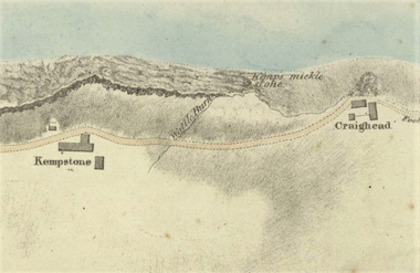
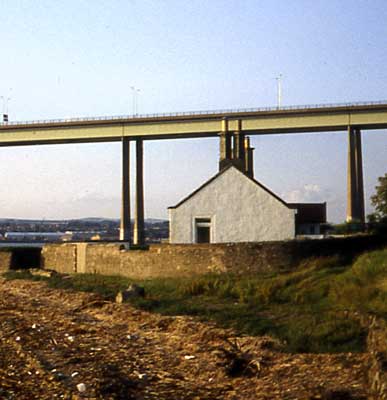
Photo / old map: Map, Steedman 1825. Reproduced with the permission of the National Library of Scotland.
 = Property demolished or site redeveloped
Notes: demolished; located east of Craighead Cottage
Location and Old Maps
Latitude, longitude: 56.446353,-2.936753
View location on the 1855 6-inch map, the 1895 25-inch map, the 1914 25-inch map, the 1966-73 25-inch map, or a 1944-50 aerial photograph at the National Library of Scotland website.
Nearby properties (demolished in red): 103 Tay Street (107 Tay Street) 109 Tay Street
Old Addresses (any dates are approximate and are usually the latest occurence of the address)
| - |
House Names (any dates are approximate and are usually the latest occurence of the name)
| Craighead Cottage [2] |
Directory entries (before 1975)
| - |
Census records
| Year | Address | Head | Notes | Rooms | ||||
|---|---|---|---|---|---|---|---|---|
| 1841 | Craighead Farm | Key | William | View household |
Valuation Roll entries
| Year | No. | Property | Proprietor | Tenant | Occupier | Value | |||
|---|---|---|---|---|---|---|---|---|---|
| - |
Railway Map References:
| Plan | Year | Ref | Description | Owner or reputed owner | Occupier | [Comments] |
|---|---|---|---|---|---|---|
| RHP85254 (G & D J) | 1845 | 6 | Dwelling house and garden ground | James Wilson (proprietor), William Berry (superior) | William Kay | [another cottage at Craighead, to the east] |
Other Sightings:
| Year | Detail | Source |
|---|---|---|
| 1825 | Building shown on map: Craighead | National Library of Scotland, Plan of the coast from Newport to Craighead, 1824-25, John Steedman |
Early Sasines:
| - |
Return to: Home Page Present-day Addresses Properties Map Old House Names Directories Valuation Rolls Sasines Census