
Location : Gateside (Old Places)
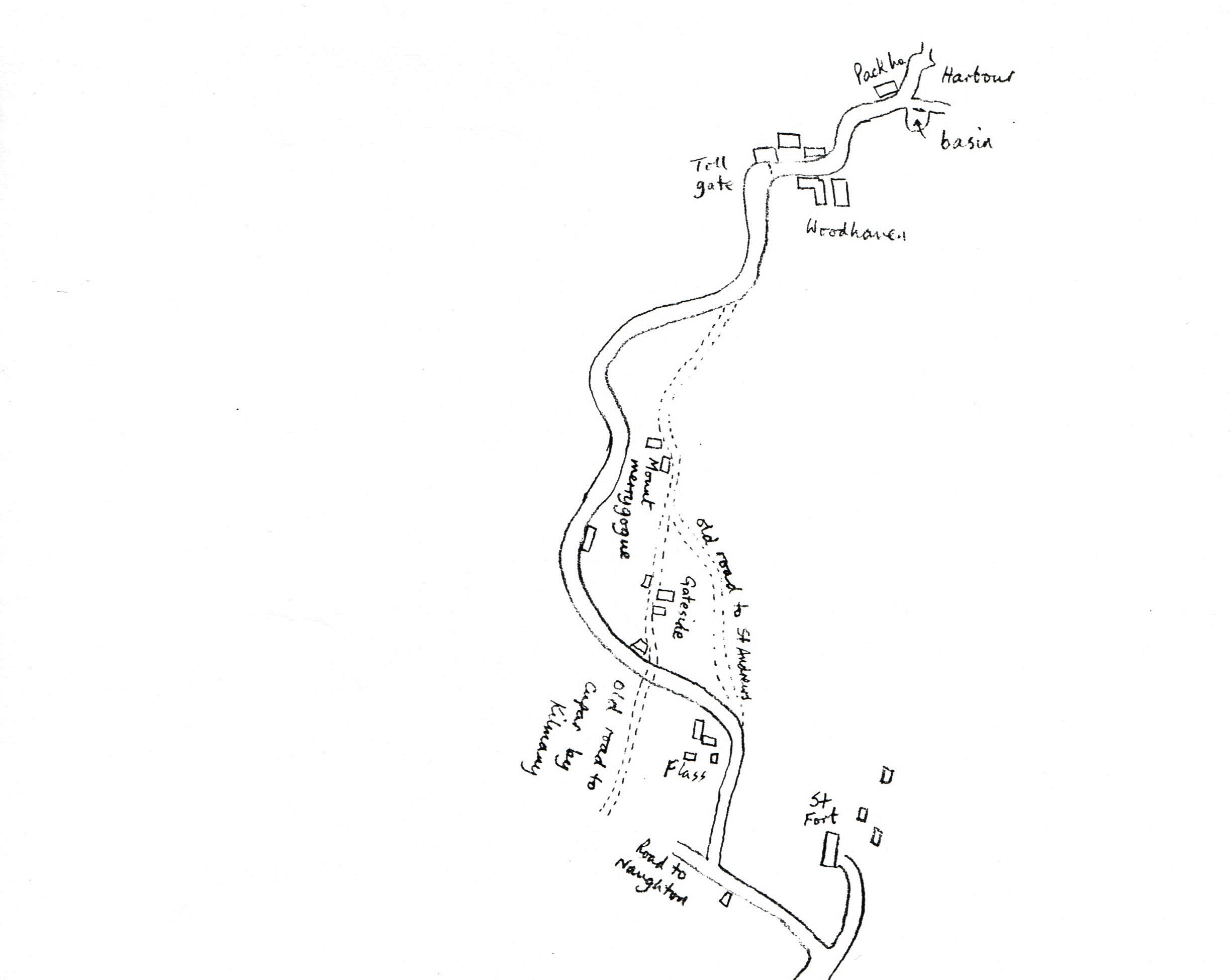
Photo / old map: Map: extracted from RHP30465
 = Property demolished or site redeveloped
Notes: demolished
Location and Old Maps
Latitude, longitude: 56.4234,-2.9632
View location on the 1855 6-inch map, the 1895 25-inch map, the 1914 25-inch map, the 1966-73 25-inch map, or a 1944-50 aerial photograph at the National Library of Scotland website.
Other Names / Spellings
| Gateside |
Sightings:
| Year | Detail | Source |
|---|---|---|
| 1794 | shown on map: north of Flass, on the old road from Woodhaven to Cupar | No image available. National Records of Scotland, RHP30465, ... the roads leading from Woodhaven to Cupar by Brackmont Miln... |
| 1735 | in Forgan Baptisms 1735 - 1837 | OPR Baptisms, Forgan parish |
Early Sasines:
| - |
Return to: Home Page Present-day Addresses Properties Map Old House Names Directories Valuation Rolls Sasines Census