Local History from Railway Plans
First, the Good News
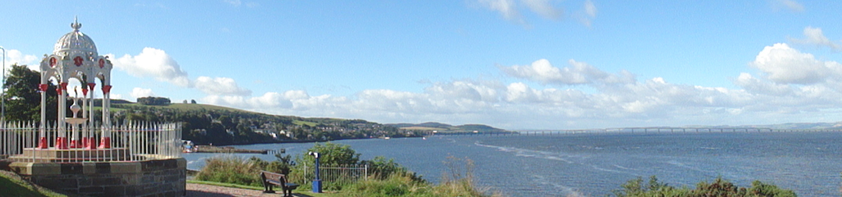
From the 1830s on, the Forth and the Tay were challenging problems for the railway companies wanting to expand north of Edinburgh. To get to Dundee and Aberdeen, they could bypass Fife altogether by going via Stirling and Perth; or they could somehow cross the Forth, traverse Fife and then somehow cross the Tay. Any lines which were to run through Fife would end up at either Ferry-Port-on-Craig (later renamed Tayport) or Newport. As the principal ferry port on the south side of the river, Newport would figure in many of the schemes.
Numerous competing railway companies proposed lines to pass through, or end at, Newport as a means of getting to Dundee. To gain interest from potential investors, schemes and plans were drawn up. Any initial or pipe-dream plans were small scale – maybe showing the whole of Fife as the size of a postcard. The more serious the proposals became, the larger the plans became. Once they got to the stage of seeking Parliamentary approval for the construction of the line, the detail shown on the plans and accompanying documentation becomes much more accurate and completely comprehensive, if only for a very limited area. This was necessary if the company was to acquire the land and buildings on the line of the new railway.
The complexities of the competing railway company proposals in the mid-1800s are manifold. Always driven by finance, the companies competed, collaborated, and frequently collapsed in their bids to gain traffic over a particular route. But even the publication of a plan and bill seeking Parliamentary approval didn’t mean that the line would be constructed. Schemes were changed, finance may not have been forthcoming, and shareholder pressure could alter the proposals.
As an example, one scheme which sought Parliamentary approval was by the Edinburgh and Northern Railway Company which proposed, in November 1845, a branch to run from Cupar through Ferry-Port-on-Craig (Tayport) then along the coast to a terminus at the Newport ferry (shown in red).
These plans are interesting from the railway historian’s point of view, but once you know they exist, the accompanying book of reference gives the local historian a lot of detail, including ownership and occupancy, about properties along the line of the intended railway at a particular point in time.
This sketch map is taken from the Edinburgh & Northern Railway (Cupar to Ferry-Port-on-Craig and Newport extension) plans, November 1845, at the National Records of Scotland, ref. RHP85261.
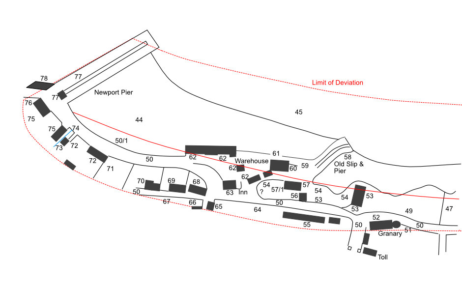
The solid red line indicates the positon of the proposed railway line. Apart from this, the plans show who owned, lived in, and had an interest in, every property along the proposed line. The properties are limited in scope to a small distance on either side of the railway line (the ‘limits of deviation’ – shown by red dashed lines), which is why some buildings are detailed on these plans while others, which are possibly more important, are not mentioned. The numbers refer to the details given in the accompanying Book of Reference.
Example from the Book of Reference:
55 : Dwelling houses & garden ground, owner William Berry, occupiers William Turnbull, John Bell, Alexander Milne, Alexander Harris, Mrs Menzies Mackie, John Kidd, Thomas Pinn & Mrs Catherine Brown. [These were houses on the west side of the present High Street.]
I have a full page about this branch line here.
This part of the line was never built. The company decided to make its terminus at Ferry-Port-on-Craig where they built a substantial harbour and operated a successful roll-on, roll-off ferry service (designed by Thomas Bouch) to Broughty Ferry.
There were many planned lines and branches over the years. I will be able to include a few of them here in due course.
The routes of some of the proposed lines do raise a few eyebrows.
Now, the Bad News
The following is not for those of a nervous disposition. It may help local historians but from a genealogist’s point of view, at the moment, it is not worth the effort.
How can you find out about any railway plans in your area? Well … with a great deal of difficulty. First you have to know that there was a railway line or a proposed line. Knowing the date and railway company can also be useful. Plans had to be submitted to the local sheriff court, so the bulk of them will now be in the National Records of Scotland (NRS), Edinburgh, referenced RHP. Some may also be in a local archive. Searching the online NRS catalogue is not an option – it is not broken down by parish. However, if you know the railway company, then you could search for that. There is another way…
For those plans in the NRS, in theory you can search ScotlandsPlaces:
- find the parish concerned
- then ‘Maps, drawings & photographs’
- options
- Organisation: National Records of Scotland
- apply filter
This will bring up a list of all plans which refer to the parish. Then, you have to search through these entries to find a set of plans for the appropriate railway company at the appropriate date. Don’t expect any links, images or further help; the location maps you are presented with are meaningless. You will only be able to find that a plan exists for that railway company somewhere in the parish. Then you will have to go to Edinburgh to see the plans and find out whether you have been lucky.
Eventually … (deep breath) … you should be able to search for and view these plans at either ScotlandsPlaces, ScotlandsPeople or the NRS websites. I think this may well be several years in the future. Good luck!