333 Squadron, Royal Norwegian Airforce at Woodhaven

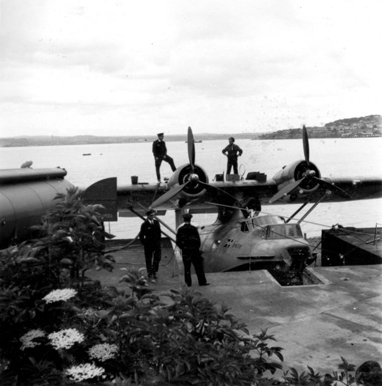
333 Squadron of the Royal Norwegian Airforce was formed when the Norwegian flag was first raised at Woodhaven on February 8th 1942. Ten days later the first Catalina PBY aircraft, designated W8424 and called Vingtor after the old Norse War God, landed in the bay.

Finn Lambrechts, the squadron’s first commander, and his flight engineer, Hans Ronningen, had flown the northern route of the Norwegian Airline DNL before they escaped from the Germans, as many others did by a variety of routes finally leading to Britain. Commander Lambrechts had observed that German defences were weak along the coast of Heligoland so that it would be possible to put agents ashore to watch and report on German coastal shipping. His proposal to form a unit was supported by the Norwegians and finally received the approval of Coastal Command.

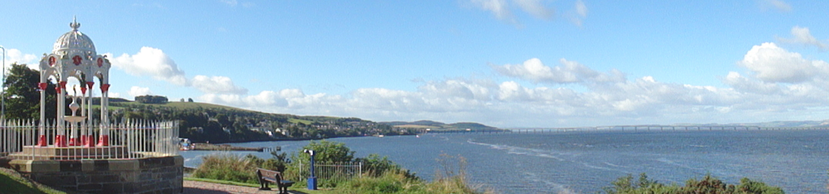
Woodhaven was chosen as the base because of its relatively isolated location which served the need for secrecy, and Catalinas – designed for anti submarine warfare and convoy escort duties – were chosen for the work. Norwegians from all over the world provided the ground crews, flight engineers and other staff needed. Initially the unit was a detachment from 210 Squadron RAF Coastal Command designated No 1477 Flight.

The Catalinas flew agents into Norway during 1942 and most of 1943. When these activities became too well known to the Germans they were used for anti submarine work and convoy escort duties to protect the American convoys heading for Murmansk. The Catalinas also patrolled ahead of the convoys to report on ice conditions. Towards the end of the war they again began to take in agents. Coded messages broadcast by the Norwegian service of the BBC were used to tell agents (and the squadron) the day on which they would be picked up or receive supplies. Sometimes the weather interfered and the date, but not the time, of an operation would be changed.

On 23rd December 1942, they flew from Woodhaven to Norway to deliver 52 sacks of Christmas presents from a height of 50 feet.

Only one casualty occurred to the Catalinas during the war when one of the flying boats was crippled by anti-aircraft fire on a raid to Norway, but it managed to get back in safety.

In March 1943 six Mosquitoes under the command of Captain Larsen were sent to Leuchars to carry out offensive action along the Norwegian coast line. On May 10th 1943 the two units were officially established as a squadron. ‘A’ Flight flew Catalinas from Woodhaven and ‘B’ Flight operated Mosquitoes from Leuchars. The squadron motto is ‘Our King our Country and the honour of our Flag’.

Contact between the Norwegians and Woodhaven residents was chiefly through William Rankine who was a firm friend of Norway and came to mean a lot to the young airmen. Other locals also did their best to help and one such was Lady Bluebell Walker who opened her home (later to become the Sandford Hotel) to the Norwegians.

King Haakon visited the unit 3 times and Crown Prince Olav once. In July 1944 King Haakon planted the two laburnum trees which are now tended by the Wormit Boating club.

The Squadron used the ‘Mars Sheds’ at Woodhaven Pier and also took over Rock House as a headquarters. Local properties, including Dunvarlich and Netherlea, were also used.

Immediately after the war the 333 Squadron took an active part in the reconstruction of northern Norway and the island settlements. Careful planning was needed to cope with the huge demand for help to restore communications.
In due course the Catalina aircraft was pensioned off to be replaced first by the Albatross and later by the Orion – a 4-engined aircraft with a cruising range of 16 to 18 hours. B Flight was later formed into 334 Squadron and now operates the Starfighter.
333 Squadron’s primary task remains the surveillance of surface underwater and air traffic including rescue operations along the Norwegian coast and in the neighbouring ocean areas. Since January 1st 1977 it has also had the specific task of watching over Norway’s 200 mile economic zone.

The memorial stone with its bronze plaque next to the laburnums and the flag pole at the Boating Club’s Race Box were generously provided by the Norwegians following correspondence between David Owen when Treasurer and Major (later Colonel) Egil Johansen who flew many missions to Norway from Woodhaven.

The stone was unveiled on 4th May 1975 by General Stenwig, R No A F, a Woodhaven veteran.

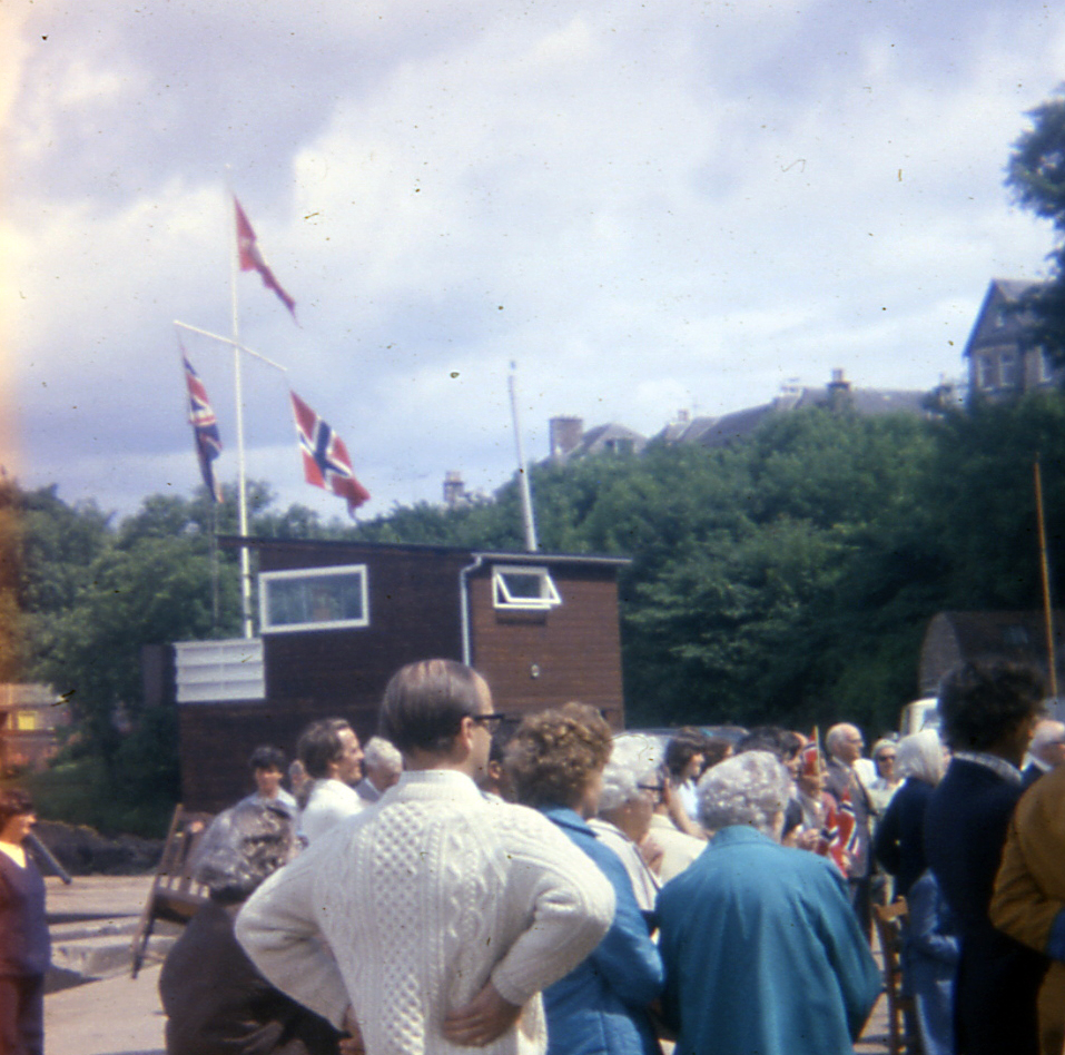
To this day, Norwegians still visit Woodhaven and the Norwegian flag is flown on Norwegian National Day, maintaining a tradition started by Mr Rankine after the war.

Over 840 photographs taken by the Norwegians during their stay are now here in the Galleries. They are reproduced with thanks to Gerd Garnes, their owner.

How the Property Information is Collated

Over thirty years ago, I drew up a grid which listed in a column all the properties on the south side of Prospect Terrace and, for each property, laid out in a row the owners / occupiers working back in time as far as I could go. I used Dundee directories and old valuation rolls as the sources of the information. This was relatively easy – these properties had changed hands only a few times in over 100 years. There were, naturally, discrepencies with the dates when comparing the data from the two sources but, overall, a fairly comprehensive picture of this one side of one street could be built up.

Over the years, this turned into a Newport- & Wormit-wide project. It was much easier to follow the properties through the valuation rolls than by using the directories, so I gathered together copies of valuation rolls at approximately 5-year intervals back to their start in 1855. This was augmented with the information from the censuses. I gathered large sheets of squared paper and put the information for each street or side of a street on one sheet. Some properties were easy to research, others remained stubbornly difficult and a few were impossible. Most entries could eventually be filled in with ink, but there were many pencil entries and not a few question marks.

Roll on to the present day when computer-searching makes things much easier. The data, of course, has to be entered before it can be searched since none of it was online. Other sources have been gathered – voters’ rolls, sasine abridgements, valuation office records, maps, etc., etc. Each source had obviously gathered information for its own specific purpose and the details of names, addresses and dates were not easily linked together. And, needless to say, the complexity, ambiguity and incomplete nature of the information can create its own problems. It helps to have local knowledge – I was a message boy for Beatt & Tait, the grocers, in the 1960s; worked on the Christmas post in the early 70s; and worked in the summer as a student labourer for Newport Town Council until it was abolished and ‘regionalisation’ took over. The background this gave me – particularly with addresses and house-names – was invaluable. To do this exercise elsewhere would be extremely difficult, but not impossible.

I am currently trying to put all this information out in the public arena, checking it all over as I go. It is a time-consuming and complex job, but the satisfaction is immense. However, there will always be areas of doubt – so I can only give a ‘best guess’ as to who lived where and when – but I am fairly confident that the vast majority are accurate.

Anyway, as an indication of the thought processes involved I can give the problem of two semi-detached properties in King Street: present-day numbers 7 and 9.

I had tracked each property through the valuation rolls back from 1967 at 5-yearly intervals to 1855. Consistently this told me that, back to 1876, no. 7 was the bigger property (it had the higher rateable value and paid the higher feu duty). It was owned and inhabited by a succession of James Murrays. Indeed I remember Peem Murray when I delivered his mail and I knew that he lived in what is now no. 7 and is the south-western part of the property, and Miss Marshall lived in the other part no. 9 (her door had ‘Marshall’ on the brass letterbox). The present-day street numbering is correct: there are some addresses which are out of numerical sequence but this is not one of them. The two properties were parts of a single property which was split and sold (albeit within the family) in 1876, the southern part going to James Murray, the northern part being retained by the rest of the family of the property’s first owner George Murray. Looking at the 1894 map, James Murray’s house is the larger. So far, so good. I started to tie in the directory entries to the relevant properties. Then came the census. Ah. Recorded in sequence, from south-west to north-east in 1911, 1901, 1891 and 1881, they all showed the smaller property first (in terms of rooms – 3 in the southern property, 4 in the northern one). Something wrong here, surely. Often the census returns aren’t listed in the exact order. But the other houses round about are correctly ordered, and they wouldn’t be wrong for every year.

The only other source that could help is the 1910 Valuation Act Field Books. I have a few transcriptions of these entries which give details of the houses around 1912. Remarkably, I had the entries for these 2 houses. Entry 142 – Miss M Murray, but shown on the map as Mrs Marshall, – same rental and value as in the valuation roll, but it is described as having ‘kitchen, upstairs room with one small room off, attic – 1 room, washhouse common’. Entry 143 – James Murray, the southern property, correct rental and value, ‘containing kitchen, scullery, room with small room off, dry WC, washhouse common’. So there we are – the larger property, with the higher value, actually has a smaller number of rooms than the other one. So all the sources were correct even if it seemed that they weren’t. I just had to tidy up all the directory entries as best I could and declare it ‘completed’.

But I still have a niggling doubt about the census room numbers.